|
|
What we do and why we do it:
- The main activity of the Wisconsin Department of Natural Resources Mississippi River Monitoring Field Station at La Crosse is performing standardized monitoring of the upper Mississippi River. Funding comes from the federal Environmental Management Program's Long Term Resource Monitoring element and the Environmental Monitoring and Assesment Program for Great River Ecology (EMAP-GRE). Key river-related resources being monitored are fish, water quality, vegetation, land cover/land use, and invertebrates. In addition, Long Term Resource Monitoring Program (LTRM) employees monitor sediments and others.
- By monitoring all these components of the river resource, we improve the chance of detecting changes that might signal problems and/or the necessity for management actions. The Long Term Resource Monitoring element includes 5 additional field stations located in the states of Iowa, Illinois, Minnesota, and Missouri and is one of the most comprehensive large river monitoring programs in the world.
- A significant amount of time is required simply to maintain and prepare the field equipment for day-to-day sampling. Field equipment at the La Crosse Field Station consists of several boats designed for various types of sampling during all seasons (i.e., an electro-fishing boat, airboat, canoes, and various flat-bottomed boats and motors), various types of nets and dredges, seines, and electronic equipment including water quality meters and global positioning systems.
- Additional duties are quite varied, but include data verification and analysis, writing reports/publications, conducting presentations at various professional scientific and interagency meetings, public relations, cooperative research, and additional monitoring activities. The WDNR's La Crosse Field Station also serves often as a testing ground for new procedures and applications prior to rolling them out to the other 5 upper Mississippi River state field stations (IL (2), IA, MN, MO) involved in the Long Term Resource Monitoring element.
Who does the work?
Up to six long-term employees and up to four short-term employees at the WDNR's La Crosse Field Station collect and analyze seasonal and year-round data from Navigation Pool 8, the 23.3-mile reach of the Mississippi river between Lock and Dam 7 at Dresbach, MN, and Lock and Dam 8 at Genoa, WI. Some areas of adjacent pools 5 - 11 are also monitored. The data we collect using standard LTRMP, DNR and EMAP-GRE procedures is analyzed along with data collected by other field stations and aerial and satellite photography collected by federal partners such as the United States Geological Survey (USGS) and the U.S. Environmental Protection Agency (EPA).
How do we fit within the Wisconsin DNR?
- The Wisconsin Department of Natural Resources Mississippi River Monitoring Field Station at La Crosse is part of the WDNR's Mississippi River Team, which is headquartered at La Crosse, Wisconsin.
- Our routine day-to-day business is conducted through the WDNR's La Crosse Service Center and through the WDNR's West Central Region Headquarters located in Eau Claire, Wisconsin.
- Our budget and Work Plan is administered through the WDNR's Water Division by the Bureau of Watershed Management in Central Office (Madison).
Where are we located?
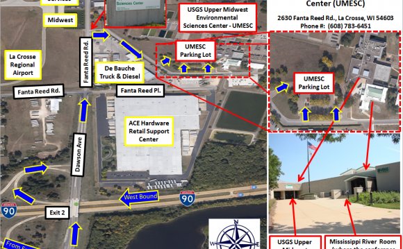
- The Wisconsin Department of Natural Resources (WDNR) Mississippi River Monitoring Field Station at La Crosse Field Station is currently located 8 miles to the north of the WDNR's La Crosse Service Center at the federal U. S. Geological Survey's Upper Midwest Environmental Sciences Center (UMESC) in La Crosse, Wisconsin. Our address is 2630 Fanta Reed Road, La Crosse, Wisconsin.
- Field Station offices are located in a separate part of the building, but garage and laboratory spaces are shared with UMESC staff. The situation is beneficial to both the Field Station and the UMESC because both entities can share equipment and staff, consolidate purchases, and have direct contact between field specialists and scientific directors as together they conduct their work on the Mississippi River.
|
 Reference September 30, 2022
 Links September 30, 2022
 Sponsors September 30, 2022
 Interesting September 30, 2022
 We are supported September 22, 2022
 Useful September 22, 2022
 Sources September 22, 2022
 Our partners September 1, 2022
 Helpful September 1, 2022